This blog is about wetlands and working with the Department of Environmental Conservation (DEC) to learn where your wetland boundaries are. By taking this step, we were able to protect our wetlands. We were also able to follow regulations, avoid fines, and avoid the DEC permitting process.
With structures to build, roads to put in, and utilities to run, it was extremely important to know exactly where our wetlands began and ended. Once we did, we were able to avoid the wetlands as well as their 100- foot buffer zone.
This helped us protect the wetlands on our property as we developed our camping facilities. Having a DEC biologist delineate our wetlands is a step we are very glad we took.
Planning Around Wetlands
There’s a lot to consider when planning a cabin cluster and campsite. Finding a way to bring guests into a beautiful natural setting while providing creature comforts and modern conveniences can be tricky. This gets a bit trickier when there are wetlands nearby.
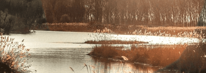
A stocked stream runs through the center of our property and wetlands surround it. Portions of the wetland are unwalkable but the vegetation and wildlife that it supports make it amazing. We wanted to protect the area and also be in compliance with regulations put in place to protect it.
Learning About Wetland Regulations
We had big plans. We wanted to bring in utilities, put in roads, and put up buildings to make our park a comfortable place to stay – all while maintaining and protecting the natural beauty of the wetlands and the rest of the property.
But we had a lot to learn about our wetlands and the regulations that protect them before we could move forward.
Finding Information
There are a ton of useful resources and information about wetlands available online. After researching, we realized that it made sense to have a Department of Environmental Conservation (DEC) biologist walk the property and map out the exact location of the wetlands.
What are wetlands?

By definition, wetlands are transition areas between uplands and aquatic habitats.
Standing water is one clue that a wetland might be present. Wetlands can also be identified by vegetation. Certain types of plants outcompete other types when they’re growing in wet soil.
Around every wetland, the 100 feet adjacent to it are also protected. This provides a buffer for wetland conservation.
Why are wetlands important?
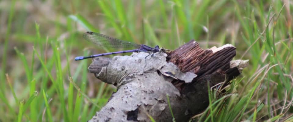
Wetlands provide a lot of benefits for the environment. They’re important for flood protection, water quality improvement, as fish and wildlife habitat, and as an environment for wetland vegetation.
Regulation and protection of wetlands
According to the information packet that the DEC sent us – “To protect the wetlands and their benefits, activities that could have a negative impact are regulated. Regulated activities include draining, dredging, filling, building structures and polluting. In the wetland and in a buffer zone (100 feet from the wetland boundary) these activities require a permit. The presence of freshwater wetlands and/or its associated 100-foot adjacent area on a property may affect where and to what extent, development can occur on a property, if at all. If wetlands are present, you may need to obtain a state and/or federal wetland permit and/or local authorization before commencing your project.”
Not all wetlands are equal
Different wetlands provide different functions and benefits in varying degrees. DEC ranks wetlands into four classes. Class I represents the greatest benefits and is most restrictive, to class IV which is least restrictive.
Exempt activities
Certain activities are exempt from regulation and don’t require a permit.
Exempt activities include:
- Normal agricultural (except filling and clear cutting)
- Recreational activities such as fishing, hunting, hiking, swimming, camping or picnicking
- Ordinary routine maintenance of existing structures, existing lawns, and similar facilities
- Selectively cutting trees and harvesting fuel wood, but not clear cutting trees or wetland vegetation
Regulated activities
Regulated activities can have minor or major potential impact on wetlands. This influences the likelihood of being granted a permit.
Regulated activities with minor impact
- Installing utilities to a residence (except in an adjacent area)
- Drilling an individual water well in an adjacent area
- Replacing existing, functional bulkheads
- Installing docks, piers, or wharfs
Regulated Activities with major impacts
- Filling and grading
- Erecting buildings
- Restoring, modifying or expanding existing structures
- Draining (except for agriculture), dredging, or otherwise changing water levels in wetlands, including breaching of beaver dams, constructing or removing bulkheads, dikes, or dams
- Constructing roads
- Applying pesticides in wetlands
- Clear cutting trees or other vegetation
- Mining
Wetland Boundary Surveys:
A DEC survey of a wetland boundary line is usually required for permits. There is no cost for the DEC Biologist to delineate the wetlands and review the map.
Information about state-regulated wetlands is available from many sources. But final and official wetland delineations, verifications, and permit requirement decisions are made by the DEC.
This is true in New York State – other states may vary.
Walking the Property with a DEC Biologist
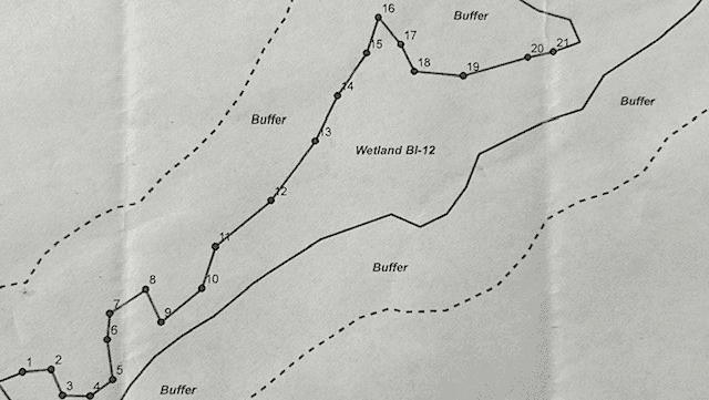
After submitting a written request for a wetland delineation, we were contacted by Chuck, a DEC Biologist. We scheduled a day to meet at the property. I carried Chuck’s shovel and spool of plastic ribbon and followed along. Chuck knew what vegetation to look for. He also dug into the muck to examine the soil.
Delineating the Wetland
When he was satisfied that he found the edge of the wetland, Chuck would mark the point with a plastic ribbon (tying it to a stake or to a shrub). Then he would enter the point into a handheld GPS. After marking 21 points along the west side of the creek, Chuck was able to officially delineate the wetland for that portion of our property.
Making Delineation Points More Permanent and More Visible
Once Chuck sent the official map (in the photo above) we marked the ribboned points with metal posts. We wrapped the posts in blue, white, and green duct tape to indicate that these were points determined by the DEC. After that, we were able to measure 100 feet from the delineation line to see if we were beyond the wetland buffer zone. Anything built or developed beyond 100 feet wouldn’t require a DEC permit.
Being able to show this boundary came in very handy when applying for local building permits. After the first couple projects, the building inspector learned our wetland boundary markers well. This greatly sped up the process.
Easier and Cheaper to Move a Building than to Get a Permit in a Wetland Buffer Zone
We had one do-over as a result of the DEC delineation. When Chuck marked the wetlands, we had already built a small camping cabin – more than 200 feet from the creek so we thought we were safe. Chuck was nice about it but told us that the cabin was in the wetland buffer zone. On the neighboring state land, the wetlands extended far away from the creek in a low- lying area.
Instead of applying for a DEC permit, we decided it would be easier for a friend with a bulldozer to pull the building out of the buffer zone. The building was small, so we were able to put it on 4 by 4 skids and pull it to its new home 18 feet away. Thankfully there were no utilities in the building so it wasn’t as difficult as it could have been. After that we knew where we could and couldn’t build and planned our property layout accordingly.
Purchasing Property with Regulated Wetlands
A reminder for the buyer to beware on this. If you’re planning to purchase or develop a parcel of land, it’s important to verify whether a regulated freshwater wetland or its regulated 100-foot adjacent area is present. If it is, you will want to determine what portion of the parcel is regulated. Taking this step can prevent future frustration and headaches and save a considerable amount of money.
Accessing and Appreciating Our Wetlands
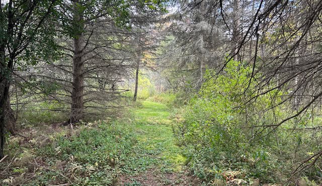
Now that we know our wetland boundaries, we are very thoughtful about how we provide our guests with access. We want to bring them close to wildlife and vegetation that they may have never seen before. A network of mowed trails with a few removable walking bridges allows easy passage. It also has almost no effect on the wetland environment.
We wish you the best of luck with your own wetland experience! Don’t hesitate to reach out via our contact page!
